Welcome to the Winter 2017 Newsletter from the Kent
Archaeological Field School
WELCOME
BREAKING NEWS: THE LOST
SOUNDS OF STONEHENGE
Dear Member, we will be sending a Newsletter
BREAKING NEWS/2: OPLONTIS
email each quarter to keep you up to date with
EXCAVATION OPPORTUNITIES
news and views on what is planned at the Kent
BREAKING NEWS/3: BORDEN
Archaeological Field School and what is
ROMAN VILLA AND ABBEY
BARNS ROMAN BUILDING IN
happening on the larger stage of archaeology
KENT
both in this country and abroad. For more
BREAKING NEWS/4: MARINE
ARCHAEOLOGISTS HAVE
I do hope you enjoy this newsletter which looks
FOUND MORE THAN 40
ANCIENT SHIPWRECKS IN THE
forward to a summer of exciting
‘digging’
BLACK SEA
opportunities. Paul Wilkinson.
RESEARCH NEWS: AERIAL
SURVEY OF KENT. PAUL
WILKINSON REPORTS ON A
RESEARCH PROJECT BY THE
KENT ARCHAEOLOGICAL
FIELD SCHOOL
Breaking News: The lost sounds of Stonehenge
COURSES AT THE KENT
ARCHAEOLOGICAL FIELD
David Sillito writing in the arts column of the London Times:
SCHOOL FOR 2017 INCLUDE:
KAFS BOOKING FORM
KAFS MEMBERSHIP FORM
There are many questions surrounding the ancient stone circle of Stonehenge
but might sound help in the search for answers?
Thomas Hardy said it had a strange "musical hum". Tess of the d'Urvbervilles ends
at Stonehenge and features the "sound". Modern-day druids also say they
experience something special when they gather at Stonehenge and play
instruments within the stone circle.
However, Stonehenge is a ruin. Whatever sound it originally had 3,000 years ago
has been lost but now, using technology created for video games and architects, Dr
Rupert Till of the University of Huddersfield has - with the help of some ancient
instruments - created a virtual sound tour of Stonehenge as it would have sounded
with all the stones in place. Arriving at 07:00 on a decidedly chilly January morning, I
was sceptical. Dr Till had arrived with a horn, a drum and some sticks to try to show
me that, even in its partially deconstructed state, there was still a distinctive echo.
Perhaps it's the mystique of the stones but it's easy to hear something. However,
sound is always going to bounce off huge standing stones: how can we say that was
in any way meaningful for people 3,000 years ago?
Dr Till says there's a great deal of evidence that ancient people were intrigued and
drawn to places that had a distinctive sound and Stonehenge had a "strange
acoustic". Even today, the wind or drumming can, he says, help generate a 47hz
bass note.
He first got a taste of what the circle might do to sound when he visited a concrete
replica of the original intact Stonehenge in Maryhill in the US state of Washington.
He has now developed an app which will help people blot out the sounds - including
those made by tourists, and cars on the nearby A303 - and go back to the
soundscape of 3,000 years ago.
He's used instruments that were used at the time, such as bone flutes and animal
horns, to give people a sense of what music would have sounded like within the
reverberation of the intact stone circle and says the site has some of the
characteristics you might expect of a rock concert venue.
Dr Till explains that there's there's strong evidence that people several thousand
years ago had an interest in acoustic environments. He's worked on caves in Spain
in which instruments have been found deep underground.
The echoes of the tunnels and cave systems may have had a special meaning for
people. There are also, what appears to be, human markings on certain "musical"
stalactites. Strike the stalactites in the right way and they give off a deep resonant
note and can be played like a huge vertical xylophone.
Stonehenge is a magnet for strange theories but this reflects a wider movement
within archaeology to try to recreate the past with the rapidly growing technology of
virtual reality (VR). Dr Aaron Watson is a research archaeologist and specialises in
visualising the past.
VR, he says, opens up a new way of researching history.
"The material record can't give us all the answers," he explains.
"The moment we start creating a virtual reality world it begins to ask questions,
especially about people. What were they wearing, what were their postures, were
they highly coloured, tattooed? As soon as we create the immersive experience it
demands those answers.
"It gives a new sensory experience to looking at the past that might take us beyond
what we describe in books."
<<<<< BACK TO MENU >>>>>
Breaking News/2: Oplontis excavation opportunities
The Oplontis Project began in 2006 with the study of the site known as Oplontis
situated at Torre Annunziata, Italy. The work is sponsored by the Center for the
Study of Ancient Italy at the University of Texas in Austin. Its two directors are John
R. Clarke and Michael L. Thomas. In addition the Kent Archaeological Field School,
Faversham, Kent UK under its director Dr Paul Wilkinson has been involved in
fieldwork at both villa sites since 2008.
The aims of the project are to enable an understanding of the two buildings, one of
which is Villa ‘A’, the other Villa ‘B’ to be enhanced through a comprehensive study
of the buildings, the fabric, the artefacts and human remains, their location, and their
function including a 3-d model with interactive database which will enable scholars
to write a series of comprehensive volumes which will be published by the
Humanities eBook series of the American Council of Learned Societies. The first
appeared in 2014.
Villa ‘A’ is now recognised as one of the most sumptuous and extravagant Roman
villas overlooking the Bay of Naples. It is thought by many that the villa was the
property of Poppaea Sabina the Younger who was born in Pompeii in AD30 and
married Nero in AD62. The evidence is somewhat circumstantial and consists of
graffiti found on an amphora which said ‘secundo poppaea’ which in translation
means ‘to the second [slave or freedman] of Poppaea’.
The villa was excavated by an Italian team over twenty years ago, and although it
was impossible because of modern development to find the limits of the villa some
99 rooms and spaces were excavated including a sixty metre swimming pool and
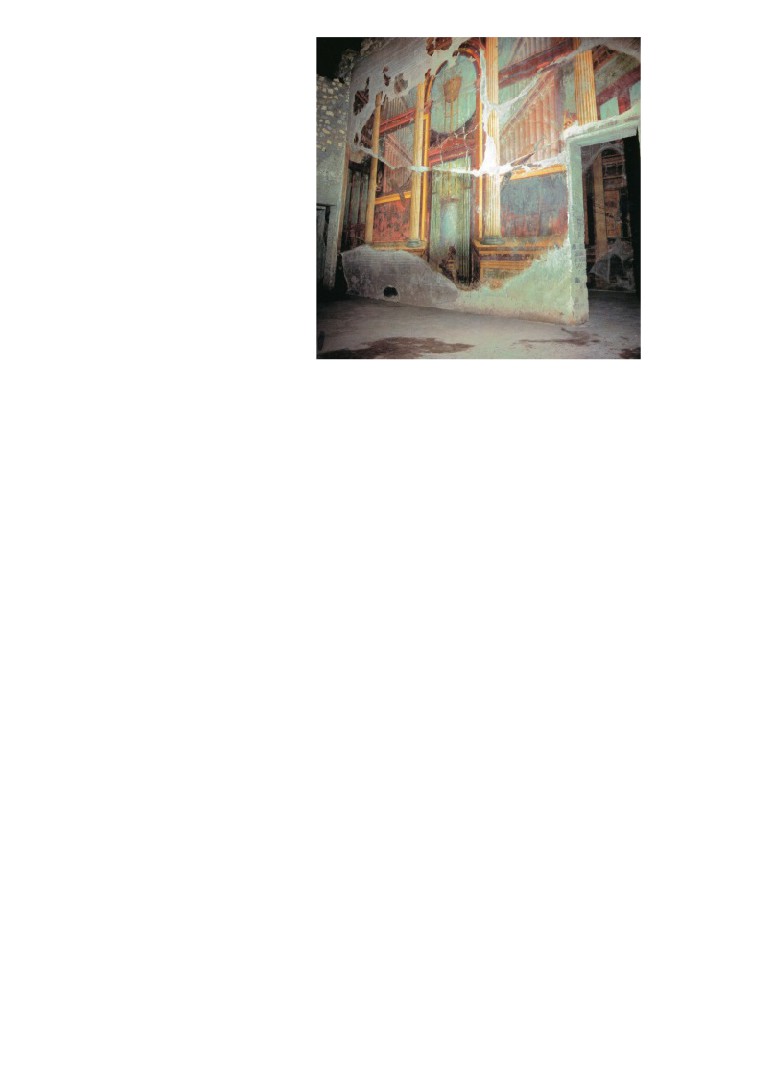
formal gardens. The villa is probably best known for its wonderful Second Style wall
frescoes which can be found in a number of rooms located around the atrium, itself
dating back to about 50BC.
Villa ‘B’ is located about 300 metres to the east of Villa ‘A’ and is not a villa. Its likely
function was a warehouse where wine would be processed and shipped out in
amphorae. Some 400 amphorae still litter the site. Around the warehouse are roads
and streets of town houses still waiting to be excavated.
The plan of the warehouse is focused on a central courtyard surrounded by a two-
storey peristyle of Nocera tufa columns. The eastern side of the peristyle includes
an entrance opening onto an unexcavated road running north south and detected
through our coring campaign. Ground floor storage rooms open up into this central
space whilst above on the second floor are residential rooms. To the south lies the
remains of a colonnade and portico and, set back, a series of large barrel vaulted
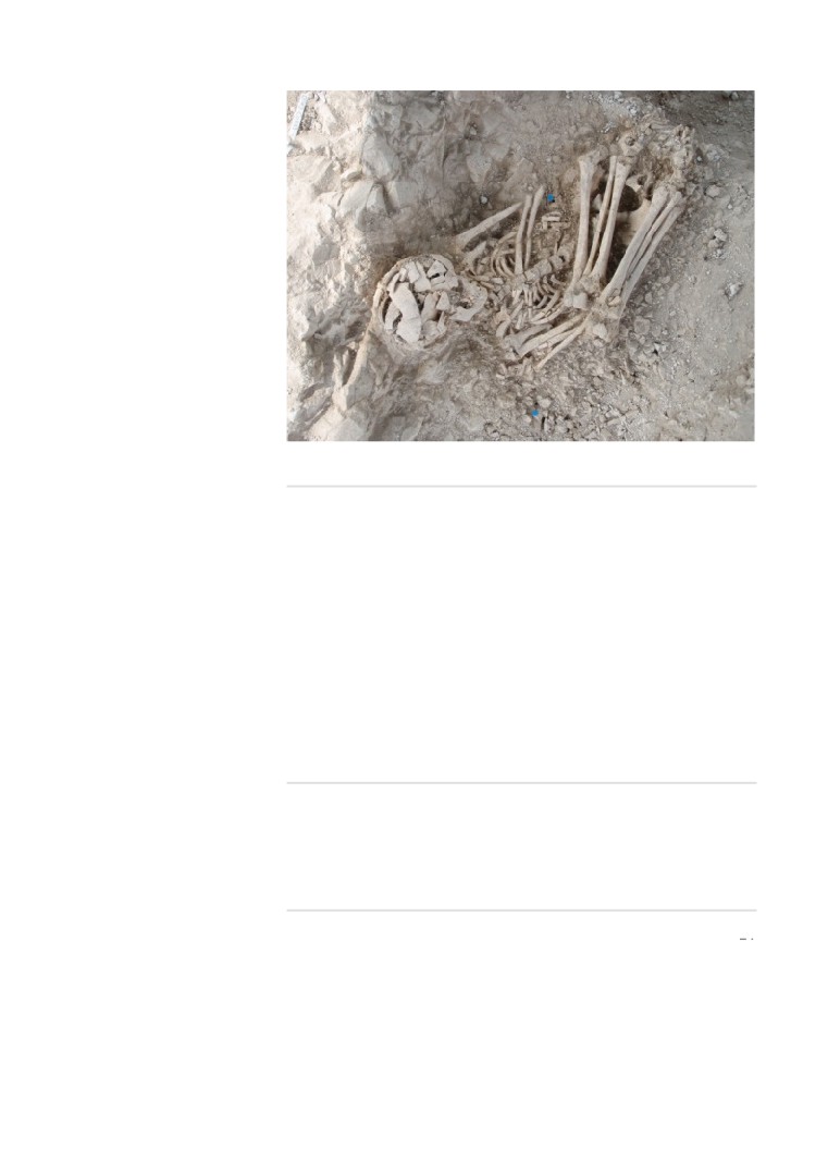
storage rooms which faced the sea. In these rooms, just as in the Roman port area
of Herculaneum, dozens of skeletons were found of people waiting to be rescued by
boat from the eruption of Vesuvius in AD79.
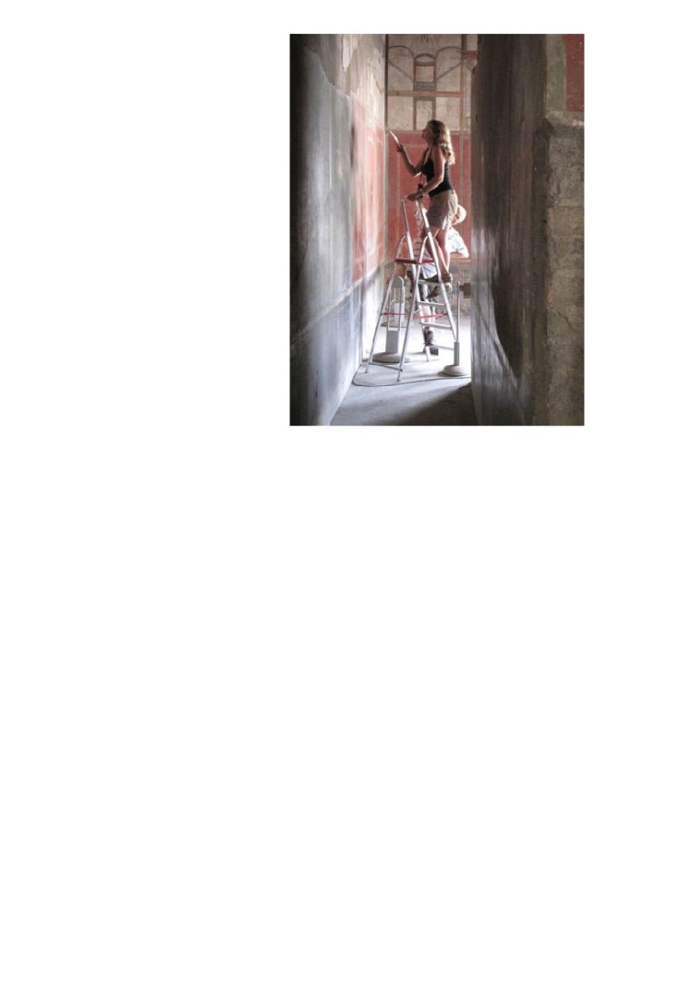
In 2008 I was invited by John Clarke to join the team and started work on site at Villa
‘A’ helping with a small evaluation trench located in the southern area of the large
swimming pool. One of its aims was to attempt to date the adjacent foundation wall
of Room 78, the large diaeta (private room) to the south-west of the swimming pool.
We excavated through demolition layers of Roman material which included
fragments of exquisite fresco, painted stucco fragments and, the most wonderful of
all, beautiful oil lamps with a variety of designs. To an archaeologist who normally
excavates Roman sites in Britain the quality and quantity of finds was staggering.
The Fourth Style fresco fragments indicated a terminus post quem date of about
45AD for the construction of the diaeta.
The following year I returned to Oplontis with a small team from the Kent
Archaeological Field School (KAFS) and a Landover full of archaeological kit. The
drive from Kent, through France, across the Alps and down the spine of Italy was
memorable and is something I still look forward to every year. In a way it is a drive
through a historic landscape, and gives one a feel of how extremes and
opportunities of landscape moulded the lives of past peoples. The 2009 season was
busy and eight trenches were excavated at Villa ‘A’. In addition Giovanni Di Maio
who had already undertaken some work on the geological formations below the villa
cored three additional areas to the south of the villa and proved that Villa ‘A’ was
situated on a cliff about 13 metres above the Roman sea level. Our work in 2009
included a test pit dug through the north-west corner of the pool. We found that the
pool had originally been larger and had been reduced in width presumably to allow
the colonnade of porticos on the west side to be built. In addition we excavated part
of a circular fountain in Room 20. It had been revealed by workmen laying cables in
2007 and not recorded. On investigation we found a partly demolished fountain
buried under a metre of demolition debris. The fountain had quite a pronounced tilt
to it which might suggest Villa ‘A’ had been subjected to serious earthquake damage
in the years before AD79. All the piping to the fountain had been robbed, and in
addition a statue which graced the south edge of the fountain was no longer there,
but its concrete ‘footprint’ was!
Another of our trenches was located in the north-east corner of the north gardens
and for once we were digging through layers of pumice deposited by the volcanic
eruption of AD79. Underneath we found an open canal 80cm in width and finished in
coating of cocciopesto (pink waterproof cement), known to archaeologists as opus
signinum. The canal runs north with a slight curve to the east under the modern car
park. The function of the aqueduct fed canal cannot be proved, but it is likely that it
was an open water feature, part of an elaborate garden which went out of use in
antiquity when it was backfilled with earth and debris.
Another garden we looked at was in Room 32, the peristyle in the servants quarters
located to the east of the main atrium. We discovered evidence for an earlier
peristyle that matched the footprint of the later build. The trench produced copious
amounts of marble mosaic flooring, opus signinum slabs, and the exquisite marble
nose from a small statue! The water features investigated in 2009 suggest that the
first phase of the villa dated to about 50BC, and was seriously damaged in the
earthquakes of AD62 with the water features decommissioned and either
demolished or backfilled. In
2010 we excavated nine trenches with a view to
unravelling the complexities of the water supply to the villa. In the south-east of the
north gardens we excavated a large cistern with a capacity of about two cubic
metres of water. It seems the cistern, constructed of opus signinum, was to prevent
flooding in this part of the garden, to hold a water supply for the garden, and for use
as a drain to the nearby portico that once lined the eastern side of the north garden
and its adjacent room. The finds from the infill of the cistern were dazzling with large
fragments of a Doric frieze constructed of super fine stucco, two types of antefixes,
and part of a column constructed of wedge-shaped bricks and with stucco flutes. It
was decided to excavate in the centre of the 60m swimming pool which required
crowbars to remove the large basalt blocks which made up the substructure of the
pool. Our daily water consumption went up from two litres a day in the shade to six
litres! The reason for digging was that the ground penetrating radar had found a
significant anomaly underneath the pool foundations. Unfortunately we did not find
any anomaly but we did expose and record the two phases of pool construction, the
eruption layers and the palaeosoils. Our attention then focused on the area
immediately south of the pool. Four trenches were dug that exposed a portico at the
south end of the pool, part of a wonderful marble floor of opus sectile, a room not
recorded before with marble steps and a Doric column with stucco fluting still in situ.
Found on these steps were copious amounts of pottery and a large piece of marble
architrave with part of an acanthus scroll or volute. Our work at Villa A has gathered
additional evidence that after the earthquake of AD62 large areas of the villa were
badly damaged The finding of part of a column drum from the adjacent east wing in
the cistern, the lifting of part of the opus sectile floor prior to the eruption of AD79,
and the remodelling of the swimming pool suggest that major re-building work was
being undertaken. The villa also had problems with its water supply which may
suggest that the villa was not habitable at the time of the eruption in AD79.Initial
GPR work had detected a series of anomalies that suggested the presence of
earlier structures under the present exposed buildings. In particular the investigation
suggested that the complex lay just a few metres from the ancient shoreline. The
wider settlement may have been a small town (Oplontis) or a commercial harbour
serving the Pompeian countryside, and will be the first of its kind discovered in the
Bay of Naples area.
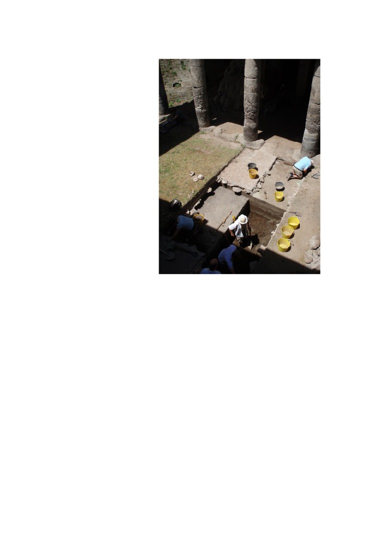
Work started in 2012 in the courtyard area with the aim of exposing the stratigraphy,
and to examine the foundations of the building which may produce evidence of its
function and chronology. We expanded the trench to the entire width of the
courtyard and soon had to resort to crowbars as the original surface of the courtyard
comprised large and occasionally very large basalt boulders with the gaps between
boulders infilled with large sherds of amphorae. Some of these still retained residue
which were bagged for analysis.
Immediately under the basalt pavement was the first of many pyroclastic flows, the
first dating to the Late Bronze Age. As we excavated down we exposed and
recorded sequence after sequence of eruption strata and palaeosoils dating as far
back as 1500-1600BC. Some of these surfaces had carted or sled ruts along with
pottery sherds and remains of mud bricks. The lowest strata were littered with
Bronze Age artefacts, and suggest there was a high level of Bronze Age activity in
the environs of Oplontis B.
Both ends of the trench gave an opportunity to investigate the foundation design of
the colonnade which was unusual to say the least. A thick tufa stylobate sits on top
of foundation blocks (sterobate) spaced to coincide with the joins between the
blocks of the stylobate with the entire assemblage sitting on the same pyroclastic
stratum which we found under the basalt paved courtyard. Sherds of Campania A
Black Gloss pottery found in the foundation trench date the build of this colonnade
to the 2nd century BC.
In 2013 we returned to this area and expanded the trench to expose a complex
water system with a settling tank plus two water channels and various drains. Of
some importance is the fact that this complex water system cut through two
previous floor levels which suggests the function of the building may have changed
through time. Another team undertook the task of removing tons of modern debris in
the area of the south portico. A thankless task undertaken in the glare of the Italian
sun! But well rewarded by exposing layers of volcanic debris from the eruption of
AD79. Underneath this layer we found the original floor surface with numerous
Neronian and Flavian coins. Below that a complex of barrel vaulted drains was
exposed which will need further investigation. Our final investigation was to examine
part of the street north of the main complex. Originally excavated by the Italian team
in the 1980’s, who discovered a street running east to west lined on both sides with
simple town houses on both sides, it is apparent that these houses have ground
floor rooms, some with the foundation step of a staircase leading to upstairs rooms,
and some of which have a simple shrine dedicated to the household gods. Our
investigation showed that some areas of the ground floor still retained debris from
the AD79 eruption and had not been excavated. Underneath we found a simple
beaten earth floor, the step for a staircase, a toilet and washing area and probably a
kitchen area. The road outside the house was also excavated and showed it had
two construction phases which may correspond to the two identified phases of the
adjacent building, the first probably dating to the 2nd century BC when the building
were probably used as workshops with a wide entrance, and the second phase
when the entrance was narrowed and the building turned into domestic quarters.
Indeed, three houses show walled up entrances, it now became a typical Roman
street that included stone benches outside of each entrance
We will be back in Oplontis in June 2017 for another season of excavation and
anyone can join our team. The only criteria is that you are a member of the Kent
Archaeological Field School www.kafs.co.uk and that you have some experience
or enthusiasm for Roman archaeology, Italian food and Italian sunshine! See also
the website for the project at www.oplontisproject.org.
Week 1. Monday 29th May to Friday 2nd June 2017 (pot washing only)
Week 2. Monday 5th June to Friday 9th June 2017 (excavation)
Week 3. Monday 12th June to Friday 16th June 2017 (excavation)
Fees: £175 a week (first week no fee).
Don’t forget to send information for the security pass
Please note food, accommodation, insurance, and travel are not included.
Flights to Naples are probably cheapest with EasyJet. To get to Pompeii take a bus
from the Naples airport to the railway station and then the local train to Pompeii.
Hotels are about 50eu for a room per night.
We are staying at are the Motel Villa dei Misteri and the Hotel degli Amici.
Transport to Oplontis from Pompeii is not provided but most of the group use the
local train (one stop). Please note it can be hot so bring sun cream and insect
07885 700 112.
Paul Wilkinson
<<<<< BACK TO MENU >>>>>
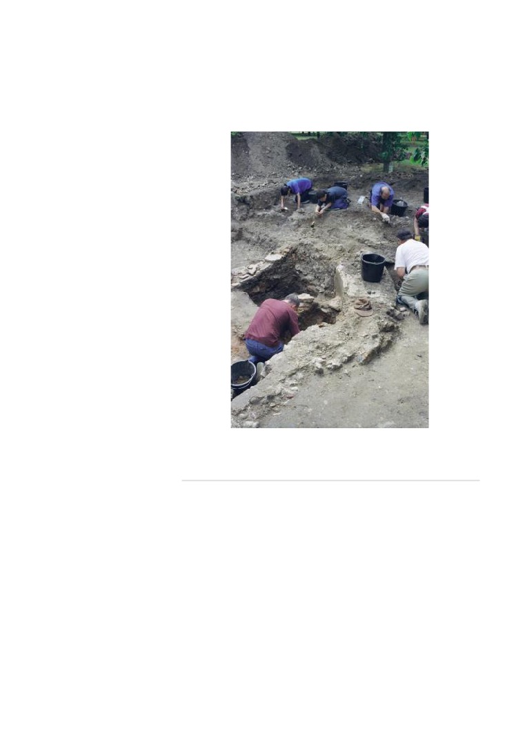
Breaking News/3: Borden Roman Villa and Abbey Barns
Roman building in Kent
Exciting news of fieldwork that took place in the summer of 2016 which expanded
our knowledge of these two additions to the corpus of known Roman villas and
estates known from the land either side of the main Roman road into Britain (Watling
Street) as it passes through North Kent between Canterbury and Rochester, both
Roman cities. The count now is 22 Roman villa estates with some very impressive
buildings which include now two stone built Roman aisled barns, a octagonal bath
house which is likely to be a Christian Baptistery and a Roman ‘cockpit’ theatre
overlooking sacred springs which are still there today plus numerous winged Roman
villa buildings.
The first phase of pottery from Borden has now been processed and dated by
Malcolm Lyne and he says there is very little pottery pre-dating c.AD 150 and most
of the material is 3rd century in date with no clear evidence for post AD 350 activity.
By way of contrast the pottery data from Abbey Barns Roman villa site in
Faversham has pottery from the Early Roman through to Late Roman and Early
Saxon periods.
Of particular importance this year at Abbey Barns is the finding of three column
bases which show clear evidence of stone built columns and not timber for the
original aisled building which became a bath house and living quarters with fresco
painted wall and opus sigininum floors
This year we will be excavating the remainder of the building from August 1st to 20th
with a training week for would-be archaeologists from Monday 7th August. Places
Paul Wilkinson
<<<<< BACK TO MENU >>>>>
Breaking News/4: Marine archaeologists have found more
than 40 ancient shipwrecks in the Black Sea
William J. Broad writes:
The medieval ship lay more than a half-mile down at the bottom of the Black Sea, its
masts, timbers and planking undisturbed in the darkness for seven or eight
centuries.
Lack of oxygen in the icy depths had ruled out the usual riot of creatures that feast
on sunken wood.
This autumn, a team of explorers lowered a robot on a long tether, lit up the wreck
with bright lights and took thousands of high-resolution photos. A computer then
merged the images into a detailed portrait.
Archaeologists date the discovery to the 13th or 14th century, opening a new
window on forerunners of the 15th- and 16th-century sailing vessels that discovered
the New World, including those of Columbus. This medieval ship probably served
the Venetian empire, which had Black Sea outposts.
Never before had this type of ship been found in such complete form. The
breakthrough was the quarterdeck, from which the captain would have directed a
crew of perhaps 20 sailors.
Experts said the success in Bulgarian waters might inspire other nations that control
portions of the Black Sea to join the archaeological hunt. They are Georgia,
Romania, Russia, Turkey and Ukraine.
Dr. Foley, who has explored a number of Black Sea wrecks, said the sea’s overall
expanse undoubtedly held tens of thousands of lost ships. “Everything that sinks out
there is going to be preserved,” he added. “They’re not going away.”
For ages, the Black Sea was a busy waterway that served the Balkans, the
Eurasian steppes, the Caucasus, Asia Minor, Mesopotamia and Greece. It long
beckoned to archaeologists because they knew its deep waters lacked oxygen, a
rarity for large bodies of water.
The great rivers of Eastern Europe — the Don, the Danube, the Dnieper — pour so
much fresh water into the sea that a permanent layer forms over denser, salty water
from the Mediterranean. As a result, oxygen from the atmosphere that mixes readily
with fresh water never penetrates the inky depths.
In 1976, Willard Bascom, a pioneer of oceanography, in his book “Deep Water,
Ancient Ships,” called the Black Sea unique among the world’s seas and a top
candidate for exploration and discovery. In 2002, Robert D. Ballard, a discoverer of
the sunken Titanic, led a Black Sea expedition that found a 2,400-year-old wreck
laden with the clay storage jars of antiquity. One held remnants of a large fish that
had been dried and cut into steaks, a popular food in ancient Greece. The new team
said it received exploratory permits from the Bulgarian ministries of culture and
foreign affairs and limited its Black Sea hunts to parts of that nation’s exclusive
economic zone, which covers thousands of square miles and runs up to roughly a
mile deep.
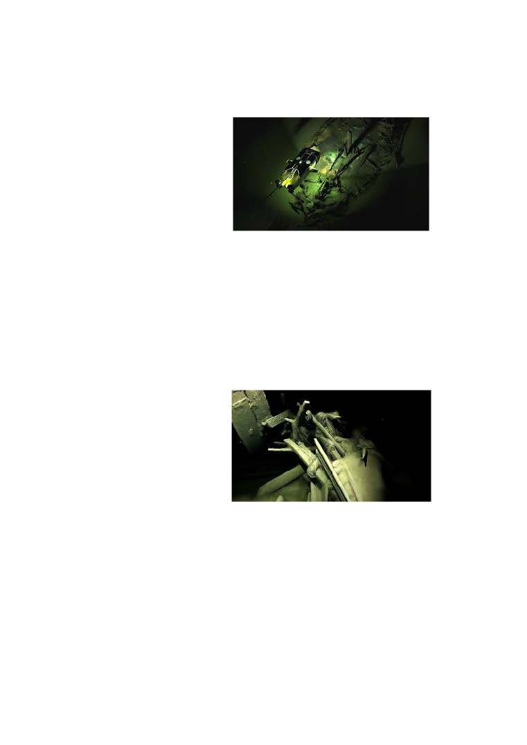
A photogrammetric image of a Byzantine wreck, dating perhaps to the ninth century.
Superimposed is an image of one of the expedition’s tethered robots that
photographed the lost ships. Credit Expedition and Education Foundation/Black Sea
MAP
,
or Black Sea MAP, it also hauls up sediments to hunt for clues to how the sea’s
rising waters engulfed former land surfaces and human settlements. Team members
listed on its website include the Bulgarian National Institute of Archaeology, the
Bulgarian Center for Underwater Archaeology, Sodertorn University in Sweden, and
the Hellenic Center for Marine Research in Greece.
A photogrammetric image of the stern of the Ottoman-era ship showing coils of rope
and a tiller with elaborate carvings. A lack of oxygen at the icy depths of the Black
Sea left the wrecks relatively undisturbed. Credit Expedition and Education
Foundation/Black Sea MAP
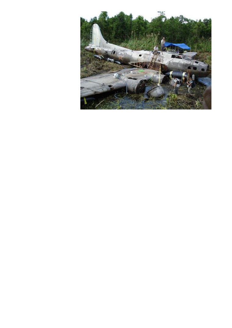
Photograph of the Month is:
‘Swamp Ghost’
Aviation archaeology is not for everyone but this particular B-17E Flying Fortress
was found in a swamp in Papua New Guinea by the Australian Air Force in 1972
and salvaged by David Tallichet and Alfred Hagen in 2010 and transported back to
the Pacific Aviation Museum at Pearl Harbour in April 2013. Piloted by Captain Fred
Eaton it was returning from a bombing raid in 1942 when it crash landed. The crew
survived and it took them six weeks to walk out of the jungle.
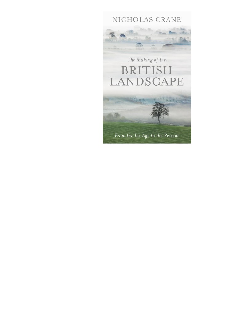
Book of the Month is:
The Making of the British Landscape by Nicholas Crane
Around 12,000 years ago Britain was still connected to the mainland of Europe.
Glaciers covered much of the north while the south was an arid wind-blasted tundra
with grasses, mosses and low shrubs. Around 9700 BC, it became a little warmer,
and that’s where Nicholas Crane’s story begins. As he argues in this ambitious,
magnificent book, Britain’s destiny was shaped to a surprising degree by the sun
and by southerners. It’s a tale of stops and starts - devastating at times, uplifting at
others.
As temperatures rose, the ice melted, greenhouse gases surged and Britain
became greener. Crane, an explorer and geographer, writes evocatively about this
changing landscape. “Relieved of its burden, the Earth’s crust sprang slowly upward
in the far north,” while the coastline of the south was reconfigured by rising sea
levels. River courses altered, trees grew taller and animals such as deer and boars
arrived.
With them came the woodland people who, unlike the early hunters, lived in large
groups and stayed for a while in one place. They brought tools and made flames
with wooden fire drills. Britain’s geology provided them with a vast array of stones,
which in turn produced a new sound: “a rhythmic knocking accompanied by high-
pitched tinkling” - the sound of the woodland people fashioning them into tools and
objects. Meanwhile Doggerland, the area that connected Britain to the continent,
was facing the onslaught of rising seas; its inhabitants marched west to escape.
Britain has always been a land of migrants.
The first “little ice age” hit around 6700BC. About 500 years later, a huge North
American lake broke through its dam and dumped such a huge amount of fresh
water into the Atlantic that the Gulf Stream shut down. Temperatures plummeted,
trees died, sea water pushed into rivers and Britain’s landscape changed again.
Only 200 years later - a geological blink - a tsunami crashed over Doggerland.
Britain became an island and isolated. Two thousand years later it was nearly
inhabited, and then the climate changed again. The next wave of immigrants arrived
- the “house people”, who crossed the channel in their boats and built the first
rectangular houses.
They bred animals, grew grains, cleared forests and sculpted the land, leaving
traces of human activity on the landscape. Crane describes growing populations,
Stonehenge and new materials
- copper, iron, bronze.
“Technology ages
landscapes,” he writes, as ore was hacked out of the land and enormous numbers
of trees were used for smelting. By 1000 BC, more of the south of Britain was
patterned by rectangular fields - in Dartmoor, for example, a grid covered 3,000
hectares. Then another little ice age hit. Then it got warmer again. And so it goes,
up and down. Forts were built, and later lowland settlements, goods arrived by ship,
and raw materials left the island.
The Emperor Claudius invaded Britain in AD43, he came, Crane says, with “an army
of psychopathic builders” and the British landscape was soon altered beyond
recognition. Camps and towns were built along gridded streets. Trees were felled,
turf was cut, ditches dug and streams diverted to lace the island with roads. Within
four generations, Britain had
24 major cities, palaces, amphitheatres, mosaic
flooring and hot baths. It was warm and the soil produced food. And then the climate
changed once more.
Crane is excellent at describing climate, geology and shifting shorelines, but is at his
best when plaiting together earth-shaping events with humankind and civilisation.
The end of the Romans in Britain, for example, was linked to a 40-year drought in
inner Asia, which started in 338 and pushed the nomadic Huns westwards, who in
turn drove the Goths into the Roman empire. With their hands full on the continent,
the Romans had problems defending Britain and trade routes were affected. Britain
was attacked, looted and robbed. Taxes were raised, which meant people couldn’t
afford goods any more, and production slowed: “life leeched from British towns”. By
407, the Romans had left and an air of disrepair veiled the south.
Crane takes his readers from the farmed countryside and the urban boom of the
Norman conquest to the freeze in the early 1300s, which was rapidly followed by
rains and famines - and then the first wave of the Black Death in 1348 (after which
came several more). As the population fell from 6 million in 1300 to 2.4 million in the
1440s, the landscape changed again: villages were abandoned and fields left
unploughed.
On behalf of Henry VIII, the marvellous John Leland surveyed the treasures in
monastic libraries but did much more. As he zigzagged the island, he read the
“landscapes as stories”, stumbling over Roman ruins and ancient earthworks. We
also meet the Dutch engineer who drained British wetlands, and Daniel Defoe
complaining about the terrible state of roads and the weather: “Hannibal himself,” he
said, “would have found it impossible to have marched his army.” Bridges, docks,
canals, enclosures, fertilisers and steam all take the stage in later chapters. Railway
fever, Crane writes, moved more earth than any previous construction scheme: hills
were cut, tunnels dug, embankments and bridges built - all to overcome the
“unhelpful undulations” of Britain’s landscape.
This book is in part about urbanisation, from the first communal settlements to
industrial cities of the 19th century. In the last decade of the 16th century, a young
Scottish cartographer marked on his map the most north-westerly part of mainland
Britain an area of
“Extreem Wilderness”: it was the last wilderness left on an
increasingly populated island. Crane writes: “to care about a place, you must know
its story”. He has given us this story.
Andrea Wulf
• Andrea Wulf’s The Invention of Nature has won the Royal Society’s science book
prize and the Costa biography award. The Making of the British Landscape is
published by Weidenfeld & Nicolson. To order a copy for £16.40 (RRP £20) go to
orders only. Phone orders min p&p of £1.99.
<<<<< BACK TO MENU >>>>>
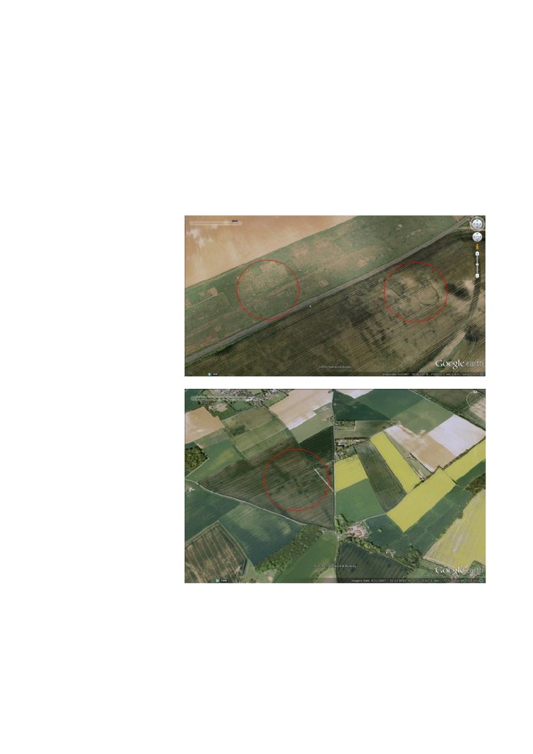
Research News: Aerial survey of Kent. Paul Wilkinson reports on a research
project by the Kent Archaeological Field School
‘If you are studying the development of the landscape in an area, almost any air
photograph is likely to contain a useful piece of information’
(Interpreting the Landscape from the Air, Mick Aston, 2002).
Students of the KAFS have started a two year programme of collating Google Earth
aerial photographs from 1940 to 2013 to enable focused information which can then
be followed up by ground survey. The fruitfulness of this can be appreciated by the
work of the field school along Watling Street in North Kent where hundreds of
important archaeological sites have been identified. The ultimate aim is to publish
the results online. Aerial photography is one of the most important remote sensing
tools available to archaeologists.
The aerial survey is now completed and the next phase of research is a programme
of field walking for 2017. KAFS members who wish to participate are invited to
contact the Director of the Field School and arrangements can be put in place.
Paul Wilkinson
AP 65980/07
AP 3257/07
<<<<< BACK TO MENU >>>>>
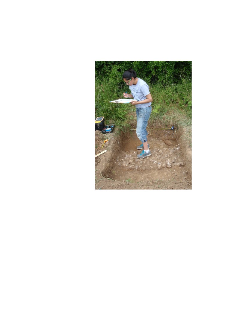
Courses at the Kent Archaeological Field School for 2017
include:
May Bank Holiday Saturday 27th May to Monday 29th
May 2017: An Introduction to Archaeological Field Walking and test pitting on
the site of a newly discovered Roman Villa at Sittingbourne
On this Bank Holiday weekend for we shall look at the ways in which archaeological
sites are found. Field walking techniques will be tested in the field and test pits dug
to confirm the extent of the Roman villa at Borden. Cost £25 for the week for non
members, members free.
Digging at Deerton Street Roman villa
May 29th to June 16th 2017 excavating at 'Villa B' at Oplontis next to Pompeii
in Italy
We will be spending three weeks in association with the University of Texas
investigating the Roman Emporium (Villa B) at Oplontis next to Pompeii. The site
offers a unique opportunity to dig on iconic World Heritage Site in Italy and is a
wonderful once in a lifetime opportunity. Cost is £175 a week which does not include
board or food but details of where to stay are available (Camping is 12EU a day and
the adjacent hotel 50EU or Airbnb).
KAFS members at Oplontis B Roman palace
August 1st to 20th 2017. The Investigation of a substantial Roman Building at
Faversham in Kent
Three weeks investigating a substantial Roman building to find out its form and
function. This is an important Roman building and part of a larger Roman villa
complex which may have its own harbour. One of the research questions we will be
tackling is the buildings marine association with the nearby tidal waterway. Cost for
the day £10 (Members free).
August 7th to August 13th 2017 Training Week for Students on a Roman
Building at Faversham in Kent
It is essential that anyone thinking of digging on an archaeological site is trained in
the procedures used in professional archaeology. Dr Paul Wilkinson, author of the
best selling "Archaeology" book and Director of the dig, will spend five days
explaining to participants the methods used in modern archaeology. A typical
training day will be classroom theory in the morning (at the Field School) followed by
excavation at a Roman villa near Faversham.
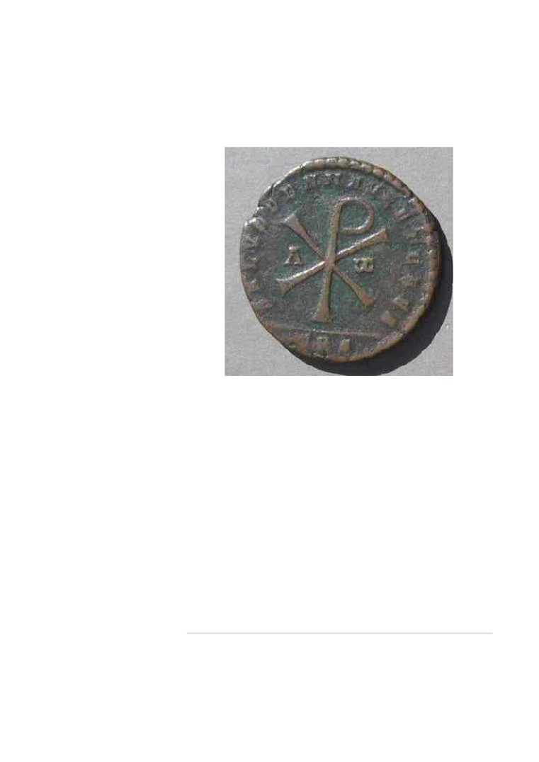
Coin from Roman building at Faversham
Topics taught each day are:
Monday 7th August: Why dig?
Tuesday 8th August: Excavation Techniques
Wednesday 9th August: Site Survey
Thursday 10th August: Archaeological Recording
Friday 11th August: Pottery identification
Saturday and Sunday (free) digging with the team
A free PDF copy of "Archaeology" 3rd Edition will be given to participants. Cost for
the course is £100 if membership is taken out at the time of booking. Non-members
£125. Certificate of Attendance. The day starts at 10am and finishes at 4.30pm. For
directions to the Field School see 'Where ' on this website. For camping nearby see
September
4th to
17th
2017. Investigation of Prehistoric features at
Hollingbourne in Kent
An opportunity to participate in excavating and recording prehistoric features in the
landscape. The week is to be spent in excavating Bronze and Iron Age features
located with aerial photography and Geophysical survey. Cost is £10 a day for non-
members, members free.
The Kent Archaeological Field School, School Farm Oast,
Graveney Road, Faversham, Kent ME13 8UP
Director Dr Paul Wilkinson
KAFS BOOKING FORM
You can download the KAFS booking form for all of our forthcoming courses directly
from our website, or by clicking here
KAFS MEMBERSHIP FORM
You can download the KAFS membership form directly from our website, or by
<<<<< BACK TO MENU >>>>>
If you would like to be removed from the KAFS mailing list please do so by clicking here